
- Start >
- Groundwater >
- Waterlevel of upper layer >
- Bayern >
- FELDOLLING R 34 >
- Current data

Current data FELDOLLING R 34
Groundwater levels of the last 12 months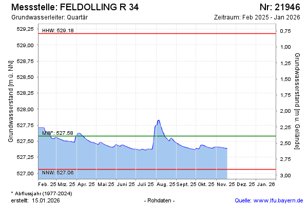
Groundwater level [m above sealevel]: 528.15
Distance to surface [m]: 1.74
Last value from 10.10.2024 13:00
Ground level [m above sealevel]: 529.89
| Date | Groundwater level [m above sealevel] |
|---|---|
| 10.10.2024 | 528.16 |
| 09.10.2024 | 528.18 |
| 08.10.2024 | 528.22 |
| 07.10.2024 | 528.28 |
| 06.10.2024 | 528.33 |
| 05.10.2024 | 528.32 |
| 04.10.2024 | 528.11 |
| 03.10.2024 | 528.08 |
© Bayerisches Landesamt für Umwelt 2024