
- Start >
- Groundwater >
- Waterlevel of upper layer >
- Bayern >
- FELDOLLING R 34 >
- Chart of total period

Chart of total period FELDOLLING R 34
Groundwater levels of the total period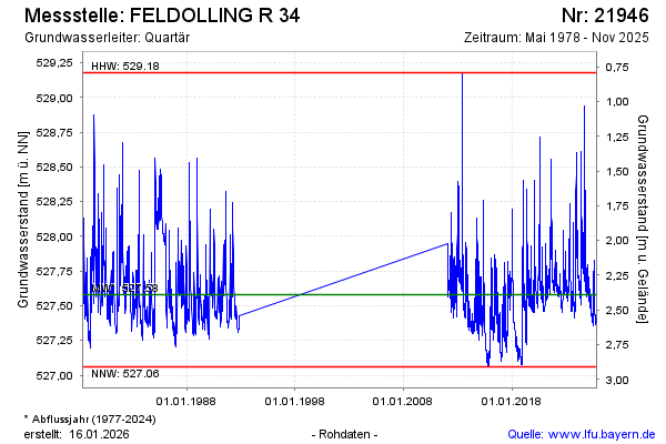
Groundwater level [m above sealevel]: 527.63
Distance to surface [m]: 2.26
Last value from 11.02.2025 13:16
Ground level [m above sealevel]: 529.89
| Date | Groundwater level [m above sealevel] |
|---|---|
| 31.12.2024 | 527.71 |
| 30.12.2024 | 527.73 |
| 29.12.2024 | 527.74 |
| 28.12.2024 | 527.76 |
| 27.12.2024 | 527.78 |
| 26.12.2024 | 527.79 |
| 25.12.2024 | 527.79 |
| 24.12.2024 | 527.79 |
© Bayerisches Landesamt für Umwelt 2025