
- Start >
- Groundwater >
- Waterlevel of upper layer >
- Bayern >
- FICHTENHOF VB1 >
- Current data

Current data FICHTENHOF VB1
Groundwater levels of the last 12 months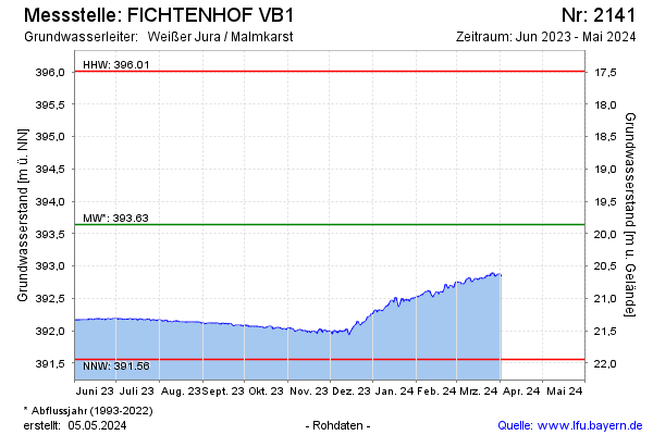
Groundwater level [m above sealevel]: 392.96
Distance to surface [m]: 20.54
Last value from 12.11.2024 13:27
Ground level [m above sealevel]: 413.50
| Date | Groundwater level [m above sealevel] |
|---|---|
| 12.11.2024 | 392.96 |
| 11.11.2024 | 392.97 |
| 10.11.2024 | 392.96 |
| 09.11.2024 | 392.97 |
| 08.11.2024 | 392.97 |
| 07.11.2024 | 392.97 |
| 06.11.2024 | 392.96 |
| 05.11.2024 | 392.98 |
© Bayerisches Landesamt für Umwelt 2024