
- Start >
- Groundwater >
- Waterlevel of upper layer >
- Bayern >
- FRAMMINGERMOOS B 411 >
- Current data

Current data FRAMMINGERMOOS B 411
Groundwater levels of the last 12 months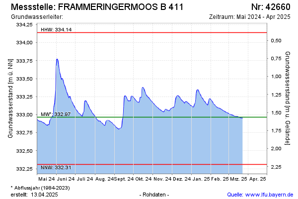
Groundwater level [m above sealevel]: 332.95
Distance to surface [m]: 1.58
Last value from 24.03.2025 00:00
Ground level [m above sealevel]: 334.53
Date | Groundwater level [m above sealevel] |
|---|---|
| 23.03.2025 | 332.95 |
| 22.03.2025 | 332.95 |
| 21.03.2025 | 332.95 |
| 20.03.2025 | 332.95 |
| 19.03.2025 | 332.96 |
| 18.03.2025 | 332.96 |
| 17.03.2025 | 332.96 |
| 16.03.2025 | 332.97 |
© Bayerisches Landesamt für Umwelt 2025