
- Start >
- Groundwater >
- Waterlevel of upper layer >
- Bayern >
- Gablonzerweg, Unterflur >
- Current data

Current data Gablonzerweg, Unterflur
Groundwater levels of the last 12 months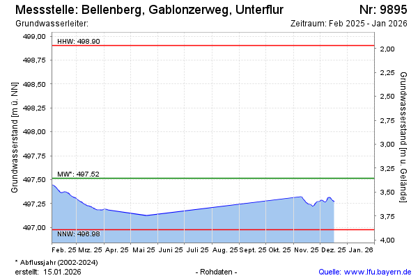
Groundwater level [m above sealevel]: 497.34
Distance to surface [m]: 3.53
Last value from 04.11.2024 10:00
Ground level [m above sealevel]: 500.87
| Date | Groundwater level [m above sealevel] |
|---|---|
| 04.11.2024 | 497.34 |
| 03.11.2024 | 497.34 |
| 02.11.2024 | 497.35 |
| 01.11.2024 | 497.37 |
| 31.10.2024 | 497.38 |
| 30.10.2024 | 497.39 |
| 29.10.2024 | 497.40 |
| 28.10.2024 | 497.41 |
© Bayerisches Landesamt für Umwelt 2024