
- Start >
- Groundwater >
- Waterlevel of upper layer >
- Bayern >
- Gablonzerweg, Unterflur >
- Chart of total period

Chart of total period Gablonzerweg, Unterflur
Groundwater levels of the total period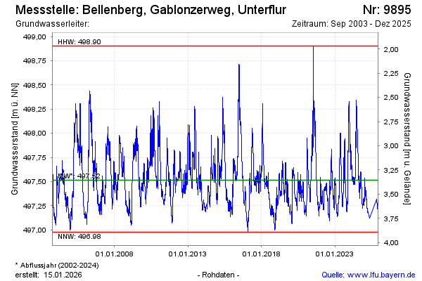
Groundwater level [m above sealevel]: 497.35
Distance to surface [m]: 3.52
Last value from 27.01.2025 14:16
Ground level [m above sealevel]: 500.87
| Date | Groundwater level [m above sealevel] |
|---|---|
| 27.01.2025 | 497.35 |
| 26.01.2025 | 497.36 |
| 25.01.2025 | 497.37 |
| 24.01.2025 | 497.38 |
| 23.01.2025 | 497.39 |
| 22.01.2025 | 497.41 |
| 21.01.2025 | 497.42 |
| 20.01.2025 | 497.44 |
© Bayerisches Landesamt für Umwelt 2025