
- Start >
- Groundwater >
- Waterlevel of upper layer >
- Bayern >
- Gangkofen B 1 >
- Chart of total period

Chart of total period Gangkofen B 1
Groundwater levels of the total period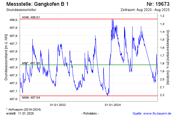
Groundwater level [m above sealevel]: 437.69
Distance to surface [m]: 1.56
Last value from 11.10.2024 14:00
Ground level [m above sealevel]: 439.25
| Date | Groundwater level [m above sealevel] |
|---|---|
| 11.10.2024 | 437.70 |
| 10.10.2024 | 437.74 |
| 09.10.2024 | 437.77 |
| 08.10.2024 | 437.73 |
| 07.10.2024 | 437.74 |
| 06.10.2024 | 437.77 |
| 05.10.2024 | 437.76 |
| 04.10.2024 | 437.74 |
© Bayerisches Landesamt für Umwelt 2024