
- Start >
- Groundwater >
- Waterlevel of upper layer >
- Bayern >
- Gangkofen B 21 >
- Current data

Current data Gangkofen B 21
Groundwater levels of the last 12 months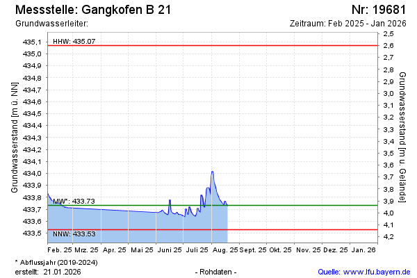
Groundwater level [m above sealevel]: 433.91
Distance to surface [m]: 3.76
Last value from 20.08.2024 11:00
Ground level [m above sealevel]: 437.67
| Date | Groundwater level [m above sealevel] |
|---|---|
| 20.08.2024 | 433.93 |
| 19.08.2024 | 433.98 |
| 18.08.2024 | 433.84 |
| 17.08.2024 | 433.72 |
| 16.08.2024 | 433.71 |
| 15.08.2024 | 433.73 |
| 14.08.2024 | 433.71 |
| 13.08.2024 | 433.71 |
© Bayerisches Landesamt für Umwelt 2024