
- Start >
- Groundwater >
- Waterlevel of upper layer >
- Bayern >
- Gangkofen B 23 >
- Current data

Current data Gangkofen B 23
Groundwater levels of the last 12 months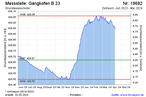
Groundwater level [m above sealevel]: 429.00
Distance to surface [m]: 8.67
Last value from 19.12.2024 10:00
Ground level [m above sealevel]: 437.67
Date | Groundwater level [m above sealevel] |
|---|---|
| 19.12.2024 | 429.00 |
| 18.12.2024 | 428.98 |
| 17.12.2024 | 428.97 |
| 16.12.2024 | 428.97 |
| 15.12.2024 | 428.97 |
| 14.12.2024 | 428.98 |
| 13.12.2024 | 428.97 |
| 12.12.2024 | 428.97 |
© Bayerisches Landesamt für Umwelt 2025