
- Start >
- Groundwater >
- Waterlevel of upper layer >
- Bayern >
- Gerlenhofen, An der Bahnlinie >
- Chart of total period

Chart of total period Gerlenhofen, An der Bahnlinie
Groundwater levels of the total period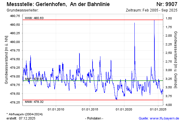
Groundwater level [m above sealevel]: 478.67
Distance to surface [m]: 3.51
Last value from 04.12.2024 14:30
Ground level [m above sealevel]: 482.18
| Date | Groundwater level [m above sealevel] |
|---|---|
| 04.12.2024 | 478.67 |
| 03.12.2024 | 478.67 |
| 02.12.2024 | 478.66 |
| 01.12.2024 | 478.66 |
| 30.11.2024 | 478.66 |
| 29.11.2024 | 478.65 |
| 28.11.2024 | 478.65 |
| 27.11.2024 | 478.65 |
© Bayerisches Landesamt für Umwelt 2025