
- Start >
- Groundwater >
- Waterlevel of upper layer >
- Bayern >
- Gerlenhofen, An der Bahnlinie >
- Chart of total period

Chart of total period Gerlenhofen, An der Bahnlinie
Groundwater levels of the total period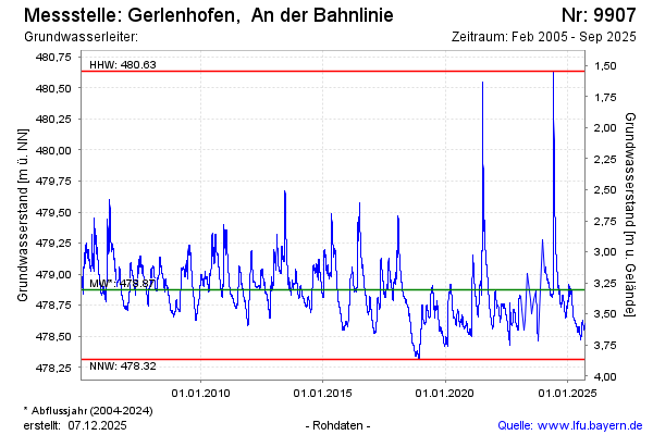
Groundwater level [m above sealevel]: 478.82
Distance to surface [m]: 3.36
Last value from 21.10.2024 13:32
Ground level [m above sealevel]: 482.18
| Date | Groundwater level [m above sealevel] |
|---|---|
| 21.10.2024 | 478.82 |
| 20.10.2024 | 478.82 |
| 19.10.2024 | 478.83 |
| 18.10.2024 | 478.83 |
| 17.10.2024 | 478.83 |
| 16.10.2024 | 478.83 |
| 15.10.2024 | 478.83 |
| 14.10.2024 | 478.83 |
© Bayerisches Landesamt für Umwelt 2024