
- Start >
- Groundwater >
- Waterlevel of upper layer >
- Bayern >
- Göttersdorf-Sportplatz >
- Chart of total period

Chart of total period Göttersdorf-Sportplatz
Groundwater levels of the total period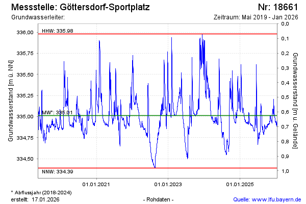
Groundwater level [m above sealevel]: 335.07
Distance to surface [m]:
Last value from 24.10.2024 11:08
Ground level [m above sealevel]: --
| Date | Groundwater level [m above sealevel] |
|---|---|
| 24.10.2024 | 335.07 |
| 23.10.2024 | 335.07 |
| 22.10.2024 | 335.09 |
| 21.10.2024 | 335.12 |
| 20.10.2024 | 335.16 |
| 19.10.2024 | 335.20 |
| 18.10.2024 | 335.27 |
| 17.10.2024 | 335.34 |
© Bayerisches Landesamt für Umwelt 2024