
- Start >
- Groundwater >
- Waterlevel of upper layer >
- Bayern >
- GRASWANG 831 >
- Chart of total period

Chart of total period GRASWANG 831
Groundwater levels of the total period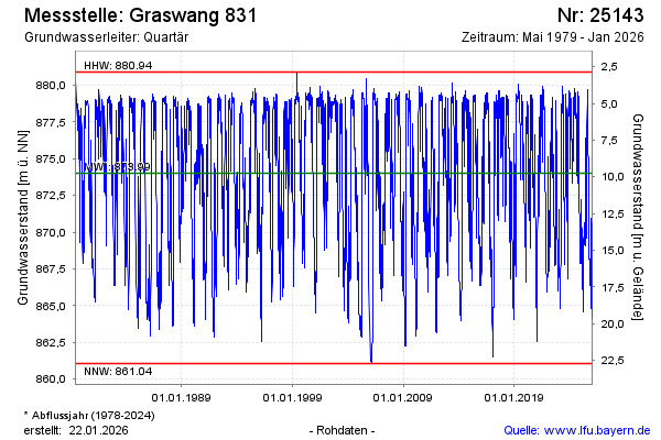
Groundwater level [m above sealevel]: 869.15
Distance to surface [m]: 14.62
Last value from 24.11.2024 21:00
Ground level [m above sealevel]: 883.77
| Date | Groundwater level [m above sealevel] |
|---|---|
| 24.11.2024 | 869.23 |
| 23.11.2024 | 869.40 |
| 22.11.2024 | 869.60 |
| 21.11.2024 | 869.80 |
| 20.11.2024 | 870.01 |
| 19.11.2024 | 870.23 |
| 18.11.2024 | 870.45 |
| 17.11.2024 | 870.68 |
© Bayerisches Landesamt für Umwelt 2024