
- Start >
- Groundwater >
- Waterlevel of upper layer >
- Bayern >
- GROEBENZELL 286 A >
- Current data

Current data GROEBENZELL 286 A
Groundwater levels of the last 12 months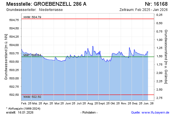
Groundwater level [m above sealevel]: 503.75
Distance to surface [m]: 1.41
Last value from 22.11.2024 05:00
Ground level [m above sealevel]: 505.16
| Date | Groundwater level [m above sealevel] |
|---|---|
| 21.11.2024 | 503.77 |
| 20.11.2024 | 503.77 |
| 19.11.2024 | 503.69 |
| 18.11.2024 | 503.69 |
| 17.11.2024 | 503.67 |
| 16.11.2024 | 503.67 |
| 15.11.2024 | 503.67 |
| 14.11.2024 | 503.67 |
© Bayerisches Landesamt für Umwelt 2024