
- Start >
- Groundwater >
- Waterlevel of upper layer >
- Bayern >
- Güntersleben >
- Chart of total period

Chart of total period Güntersleben
Groundwater levels of the total period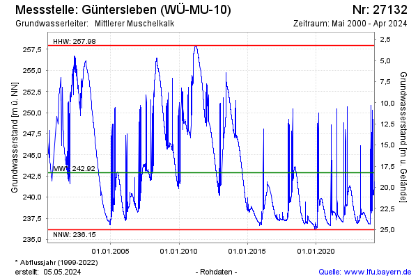
Groundwater level [m above sealevel]: 242.20
Distance to surface [m]: 18.97
Last value from 22.10.2024 10:18
Ground level [m above sealevel]: 261.17
| Date | Groundwater level [m above sealevel] |
|---|---|
| 22.10.2024 | 242.24 |
| 21.10.2024 | 242.25 |
| 20.10.2024 | 242.29 |
| 19.10.2024 | 242.35 |
| 18.10.2024 | 242.44 |
| 17.10.2024 | 242.48 |
| 16.10.2024 | 242.53 |
| 15.10.2024 | 242.51 |
© Bayerisches Landesamt für Umwelt 2024