
- Start >
- Groundwater >
- Waterlevel of upper layer >
- Bayern >
- GUN ZUR ALTMUEHL 7223 >
- Current data

Current data GUN ZUR ALTMUEHL 7223
Groundwater levels of the last 12 months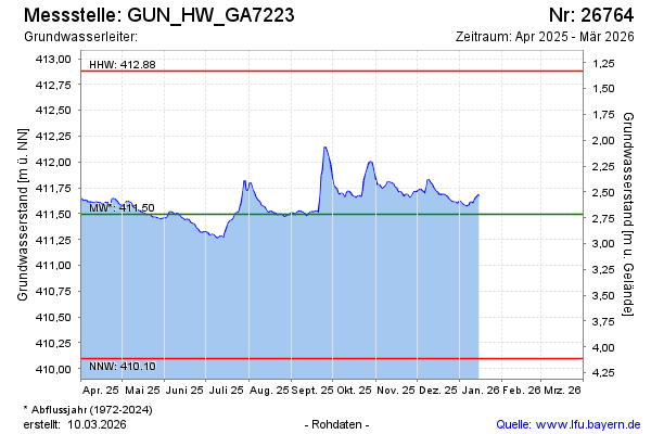
Groundwater level [m above sealevel]: 411.80
Distance to surface [m]: 2.41
Last value from 18.09.2024 10:32
Ground level [m above sealevel]: 414.21
| Date | Groundwater level [m above sealevel] |
|---|---|
| 18.09.2024 | 411.80 |
| 17.09.2024 | 411.80 |
| 16.09.2024 | 411.72 |
| 15.09.2024 | 411.68 |
| 14.09.2024 | 411.68 |
| 13.09.2024 | 411.70 |
| 12.09.2024 | 411.72 |
| 11.09.2024 | 411.70 |
© Bayerisches Landesamt für Umwelt 2024