
- Start >
- Groundwater >
- Waterlevel of upper layer >
- Bayern >
- HA2-HWS Hirten >
- Chart of total period

Chart of total period HA2-HWS Hirten
Groundwater levels of the total period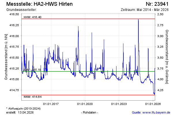
Groundwater level [m above sealevel]: 415.93
Distance to surface [m]: 3.08
Last value from 24.09.2024 08:56
Ground level [m above sealevel]: 419.01
| Date | Groundwater level [m above sealevel] |
|---|---|
| 24.09.2024 | 415.94 |
| 23.09.2024 | 415.98 |
| 22.09.2024 | 416.04 |
| 21.09.2024 | 416.10 |
| 20.09.2024 | 416.16 |
| 19.09.2024 | 416.22 |
| 18.09.2024 | 416.32 |
| 17.09.2024 | 416.38 |
© Bayerisches Landesamt für Umwelt 2024