
- Start >
- Groundwater >
- Waterlevel of upper layer >
- Bayern >
- HEINRICHSTAL BO A >
- Chart of total period

Chart of total period HEINRICHSTAL BO A
Groundwater levels of the total period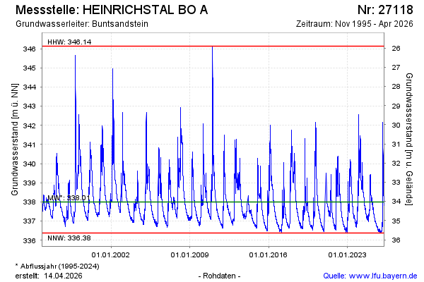
Groundwater level [m above sealevel]: 337.84
Distance to surface [m]: 34.19
Last value from 25.12.2024 10:00
Ground level [m above sealevel]: 372.03
| Date | Groundwater level [m above sealevel] |
|---|---|
| 25.12.2024 | 337.84 |
| 24.12.2024 | 337.82 |
| 23.12.2024 | 337.76 |
| 22.12.2024 | 337.68 |
| 21.12.2024 | 337.57 |
| 20.12.2024 | 337.58 |
| 19.12.2024 | 337.61 |
| 18.12.2024 | 337.53 |
© Bayerisches Landesamt für Umwelt 2024