
- Start >
- Groundwater >
- Waterlevel of upper layer >
- Bayern >
- Hochmutting Süd >
- Current data

Current data Hochmutting Süd
Groundwater levels of the last 12 months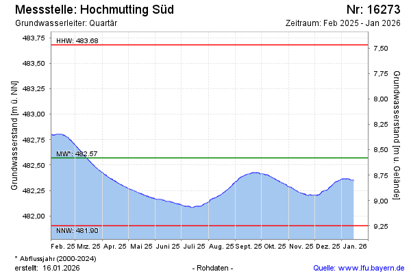
Groundwater level [m above sealevel]: 482.76
Distance to surface [m]: 8.39
Last value from 12.09.2024 10:00
Ground level [m above sealevel]: 491.15
| Date | Groundwater level [m above sealevel] |
|---|---|
| 11.09.2024 | 482.77 |
| 10.09.2024 | 482.78 |
| 09.09.2024 | 482.78 |
| 08.09.2024 | 482.79 |
| 07.09.2024 | 482.80 |
| 06.09.2024 | 482.80 |
| 05.09.2024 | 482.81 |
| 04.09.2024 | 482.82 |
© Bayerisches Landesamt für Umwelt 2024