
- Start >
- Groundwater >
- Waterlevel of upper layer >
- Bayern >
- HWF-DONAUWOERTH P2 >
- Chart of total period

Chart of total period HWF-DONAUWOERTH P2
Groundwater levels of the total period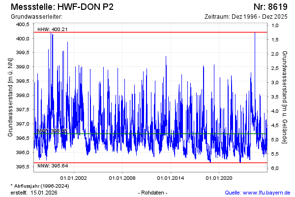
Groundwater level [m above sealevel]: 397.02
Distance to surface [m]: 4.43
Last value from 19.09.2024 15:03
Ground level [m above sealevel]: 401.45
| Date | Groundwater level [m above sealevel] |
|---|---|
| 19.09.2024 | 397.13 |
| 18.09.2024 | 397.44 |
| 17.09.2024 | 397.23 |
| 16.09.2024 | 396.90 |
| 15.09.2024 | 397.06 |
| 14.09.2024 | 396.82 |
| 13.09.2024 | 396.64 |
| 12.09.2024 | 396.64 |
© Bayerisches Landesamt für Umwelt 2024