
- Start >
- Groundwater >
- Waterlevel of upper layer >
- Bayern >
- Illerzell, Friedhof N6 >
- Chart of total period

Chart of total period Illerzell, Friedhof N6
Groundwater levels of the total period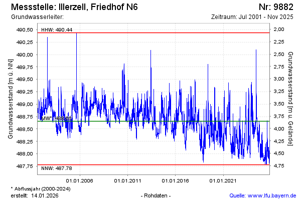
Groundwater level [m above sealevel]: 487.94
Distance to surface [m]: 4.57
Last value from 23.01.2025 14:15
Ground level [m above sealevel]: 492.51
| Date | Groundwater level [m above sealevel] |
|---|---|
| 23.01.2025 | 487.95 |
| 22.01.2025 | 487.96 |
| 21.01.2025 | 487.98 |
| 20.01.2025 | 488.00 |
| 19.01.2025 | 488.03 |
| 18.01.2025 | 488.06 |
| 17.01.2025 | 488.09 |
| 16.01.2025 | 488.14 |
© Bayerisches Landesamt für Umwelt 2025