
- Start >
- Groundwater >
- Waterlevel of upper layer >
- Bayern >
- InfraServ W-TBY >
- Current data

Current data InfraServ W-TBY
Groundwater levels of the last 12 months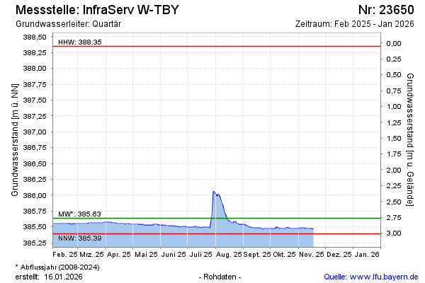
Groundwater level [m above sealevel]: 385.56
Distance to surface [m]: 2.84
Last value from 13.03.2025 12:00
Ground level [m above sealevel]: 388.40
| Date | Groundwater level [m above sealevel] |
|---|---|
| 31.12.2024 | 385.58 |
| 30.12.2024 | 385.59 |
| 29.12.2024 | 385.59 |
| 28.12.2024 | 385.59 |
| 27.12.2024 | 385.60 |
| 26.12.2024 | 385.60 |
| 25.12.2024 | 385.59 |
| 24.12.2024 | 385.59 |
© Bayerisches Landesamt für Umwelt 2025