
- Start >
- Groundwater >
- Waterlevel of upper layer >
- Bayern >
- Kaltenbach - Kufsteiner Str. 122 >
- Chart of total period

Chart of total period Kaltenbach - Kufsteiner Str. 122
Groundwater levels of the total period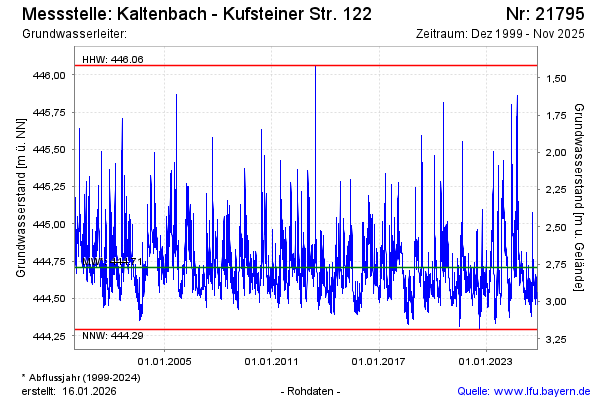
Groundwater level [m above sealevel]: 444.68
Distance to surface [m]: 2.80
Last value from 03.12.2024 11:23
Ground level [m above sealevel]: 447.48
| Date | Groundwater level [m above sealevel] |
|---|---|
| 03.12.2024 | 444.67 |
| 02.12.2024 | 444.67 |
| 01.12.2024 | 444.69 |
| 30.11.2024 | 444.72 |
| 29.11.2024 | 444.72 |
| 28.11.2024 | 444.67 |
| 27.11.2024 | 444.63 |
| 26.11.2024 | 444.63 |
© Bayerisches Landesamt für Umwelt 2024