
- Start >
- Groundwater >
- Waterlevel of upper layer >
- Bayern >
- KOTHAU 134A >
- Year chart of precipitation

Year chart of precipitation KOTHAU 134A
Groundwater levels of the last 12 months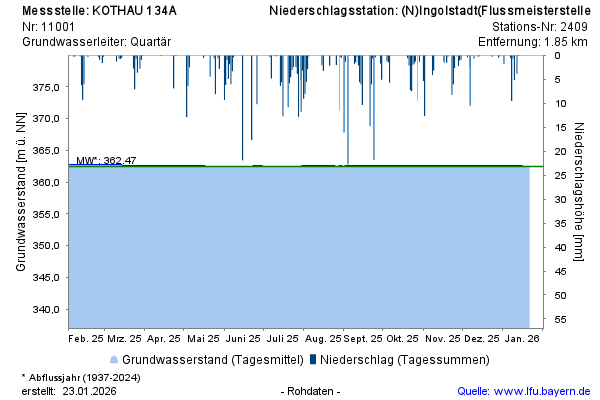
Groundwater level [m above sealevel]: 362,64
Distance to surface [m]: 3,11
Last value from 23.11.2024 10:00
Ground level [m above sealevel]: 365.75
© Bayerisches Landesamt für Umwelt 2024