
- Start >
- Groundwater >
- Waterlevel of upper layer >
- Bayern >
- Krumbach WWA >
- Chart of total period

Chart of total period Krumbach WWA
Groundwater levels of the total period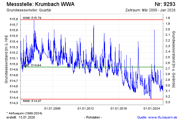
Groundwater level [m above sealevel]: 514.71
Distance to surface [m]: 2.91
Last value from 26.12.2024 12:00
Ground level [m above sealevel]: 517.62
| Date | Groundwater level [m above sealevel] |
|---|---|
| 26.12.2024 | 514.71 |
| 25.12.2024 | 514.71 |
| 24.12.2024 | 514.71 |
| 23.12.2024 | 514.72 |
| 22.12.2024 | 514.69 |
| 21.12.2024 | 514.64 |
| 20.12.2024 | 514.64 |
| 19.12.2024 | 514.66 |
© Bayerisches Landesamt für Umwelt 2024