
- Start >
- Groundwater >
- Waterlevel of upper layer >
- Bayern >
- KULMBACH Blaich 1 >
- Chart of total period

Chart of total period KULMBACH Blaich 1
Groundwater levels of the total period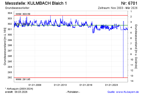
Groundwater level [m above sealevel]: 300.85
Distance to surface [m]: 4.49
Last value from 30.10.2024 10:37
Ground level [m above sealevel]: 305.34
| Date | Groundwater level [m above sealevel] |
|---|---|
| 18.09.2024 | 301.43 |
| 16.07.2024 | 301.68 |
| 18.06.2024 | 301.74 |
| 17.06.2024 | 301.75 |
| 10.06.2024 | 301.84 |
| 09.06.2024 | 301.71 |
| 01.06.2024 | 301.69 |
| 31.05.2024 | 301.68 |
© Bayerisches Landesamt für Umwelt 2024