
- Start >
- Groundwater >
- Waterlevel of upper layer >
- Bayern >
- KULMBACH Blaich 4 >
- Chart of total period

Chart of total period KULMBACH Blaich 4
Groundwater levels of the total period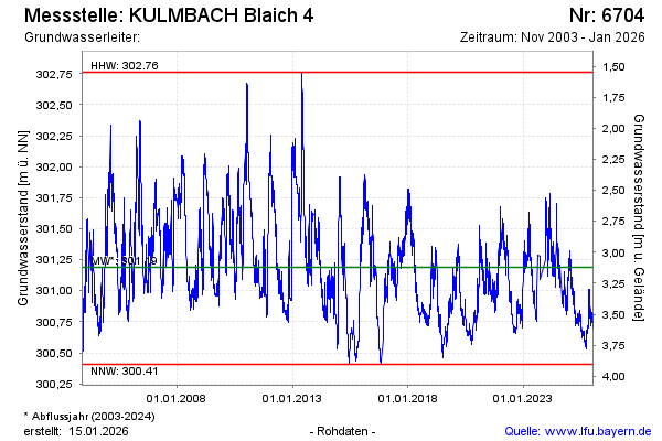
Groundwater level [m above sealevel]: 300.96
Distance to surface [m]: 3.35
Last value from 13.03.2025 10:00
Ground level [m above sealevel]: 304.31
| Date | Groundwater level [m above sealevel] |
|---|---|
| 13.03.2025 | 300.97 |
| 12.03.2025 | 300.97 |
| 11.03.2025 | 300.97 |
| 10.03.2025 | 300.99 |
| 09.03.2025 | 300.98 |
| 08.03.2025 | 300.95 |
| 07.03.2025 | 300.93 |
| 06.03.2025 | 300.93 |
© Bayerisches Landesamt für Umwelt 2025