
- Start >
- Groundwater >
- Waterlevel of upper layer >
- Bayern >
- Langenaltheim >
- Chart of total period

Chart of total period Langenaltheim
Groundwater levels of the total period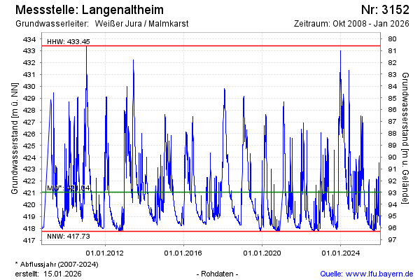
Groundwater level [m above sealevel]: 425.88
Distance to surface [m]: 88.15
Last value from 16.02.2025 13:00
Ground level [m above sealevel]: 514.03
| Date | Groundwater level [m above sealevel] |
|---|---|
| 16.02.2025 | 426.04 |
| 15.02.2025 | 426.42 |
| 14.02.2025 | 426.90 |
| 13.02.2025 | 425.42 |
| 12.02.2025 | 422.81 |
| 11.02.2025 | 422.11 |
| 10.02.2025 | 422.22 |
| 09.02.2025 | 422.49 |
© Bayerisches Landesamt für Umwelt 2025