
- Start >
- Groundwater >
- Waterlevel of upper layer >
- Bayern >
- LANGENDORF 223 >
- Chart of total period

Chart of total period LANGENDORF 223
Groundwater levels of the total period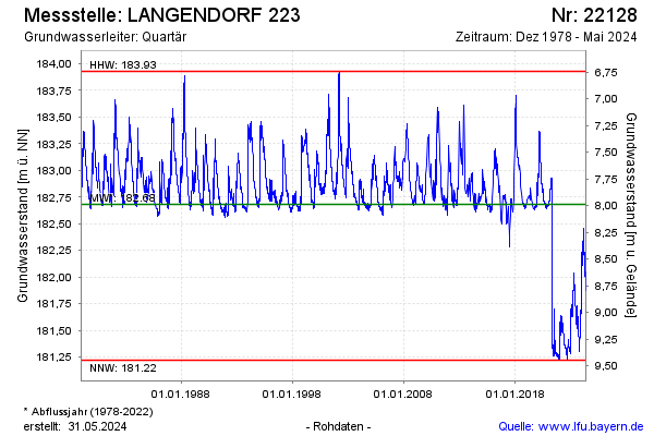
Groundwater level [m above sealevel]: 181.37
Distance to surface [m]: 9.30
Last value from 17.12.2024 10:00
Ground level [m above sealevel]: 190.67
| Date | Groundwater level [m above sealevel] |
|---|---|
| 17.12.2024 | 181.37 |
| 16.12.2024 | 181.38 |
| 15.12.2024 | 181.38 |
| 14.12.2024 | 181.39 |
| 13.12.2024 | 181.40 |
| 12.12.2024 | 181.41 |
| 11.12.2024 | 181.41 |
| 10.12.2024 | 181.42 |
© Bayerisches Landesamt für Umwelt 2024