
- Start >
- Groundwater >
- Waterlevel of upper layer >
- Bayern >
- LAUCHDORF 560 >
- Chart of total period

Chart of total period LAUCHDORF 560
Groundwater levels of the total period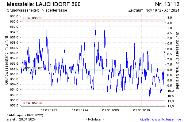
Groundwater level [m above sealevel]: 656.54
Distance to surface [m]: 7.36
Last value from 26.12.2024 04:00
Ground level [m above sealevel]: 663.90
| Date | Groundwater level [m above sealevel] |
|---|---|
| 26.12.2024 | 656.54 |
| 25.12.2024 | 656.54 |
| 24.12.2024 | 656.56 |
| 23.12.2024 | 656.57 |
| 22.12.2024 | 656.59 |
| 21.12.2024 | 656.60 |
| 20.12.2024 | 656.61 |
| 19.12.2024 | 656.63 |
© Bayerisches Landesamt für Umwelt 2024