
- Start >
- Groundwater >
- Waterlevel of upper layer >
- Bayern >
- LAUCHDORF 561 >
- Chart of total period

Chart of total period LAUCHDORF 561
Groundwater levels of the total period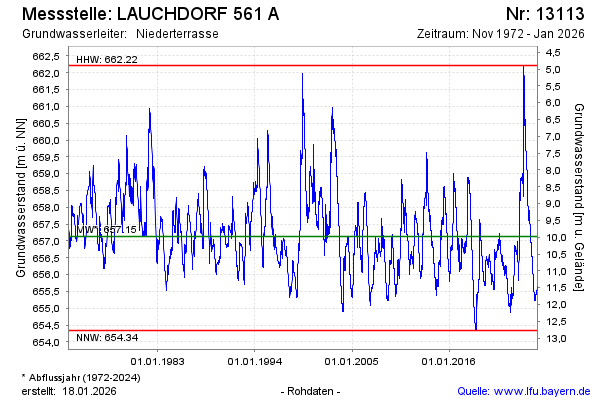
Groundwater level [m above sealevel]: 658.34
Distance to surface [m]: 8.77
Last value from 12.11.2024 09:38
Ground level [m above sealevel]: 667.11
| Date | Groundwater level [m above sealevel] |
|---|---|
| 12.11.2024 | 658.35 |
| 11.11.2024 | 658.37 |
| 10.11.2024 | 658.40 |
| 09.11.2024 | 658.43 |
| 08.11.2024 | 658.46 |
| 07.11.2024 | 658.48 |
| 06.11.2024 | 658.51 |
| 05.11.2024 | 658.54 |
© Bayerisches Landesamt für Umwelt 2024