
- Start >
- Groundwater >
- Waterlevel of upper layer >
- Bayern >
- LERCHENFELD Q4 >
- Current data

Current data LERCHENFELD Q4
Groundwater levels of the last 12 months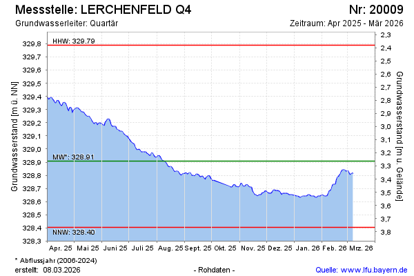
Groundwater level [m above sealevel]: 329.41
Distance to surface [m]: 2.76
Last value from 12.01.2025 10:00
Ground level [m above sealevel]: 332.17
| Date | Groundwater level [m above sealevel] |
|---|---|
| 12.01.2025 | 329.41 |
| 11.01.2025 | 329.42 |
| 10.01.2025 | 329.44 |
| 09.01.2025 | 329.42 |
| 08.01.2025 | 329.38 |
| 07.01.2025 | 329.37 |
| 06.01.2025 | 329.35 |
| 05.01.2025 | 329.32 |
© Bayerisches Landesamt für Umwelt 2025