
- Start >
- Groundwater >
- Waterlevel of upper layer >
- Bayern >
- LOHR A. MAIN/FARBMUEH. >
- Year chart of precipitation

Year chart of precipitation LOHR A. MAIN/FARBMUEH.
Groundwater levels of the last 12 months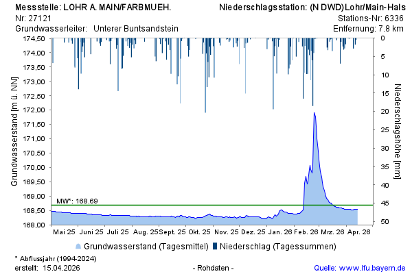
Groundwater level [m above sealevel]: 168,42
Distance to surface [m]: 46,32
Last value from 19.11.2024 10:00
Ground level [m above sealevel]: 214.74
© Bayerisches Landesamt für Umwelt 2024