
- Start >
- Groundwater >
- Waterlevel of upper layer >
- Bayern >
- Ludwigsfeld süd, Illerkanal >
- Current data

Current data Ludwigsfeld süd, Illerkanal
Groundwater levels of the last 12 months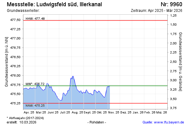
Groundwater level [m above sealevel]: 475.43
Distance to surface [m]: 3.44
Last value from 06.03.2025 13:56
Ground level [m above sealevel]: 478.87
Date | Groundwater level [m above sealevel] |
|---|---|
| 06.03.2025 | 475.43 |
| 05.03.2025 | 475.44 |
| 04.03.2025 | 475.44 |
| 03.03.2025 | 475.45 |
| 02.03.2025 | 475.46 |
| 01.03.2025 | 475.47 |
| 28.02.2025 | 475.47 |
| 27.02.2025 | 475.48 |
© Bayerisches Landesamt für Umwelt 2025