
- Start >
- Groundwater >
- Waterlevel of upper layer >
- Bayern >
- Manching HWS B6 >
- Chart of total period

Chart of total period Manching HWS B6
Groundwater levels of the total period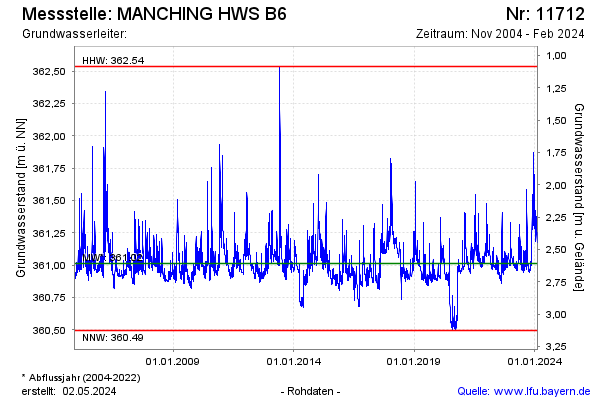
Groundwater level [m above sealevel]: 361.26
Distance to surface [m]: 2.36
Last value from 09.10.2024 11:00
Ground level [m above sealevel]: 363.62
| Date | Groundwater level [m above sealevel] |
|---|---|
| 09.10.2024 | 361.26 |
| 08.10.2024 | 361.25 |
| 07.10.2024 | 361.26 |
| 06.10.2024 | 361.27 |
| 05.10.2024 | 361.27 |
| 04.10.2024 | 361.29 |
| 03.10.2024 | 361.30 |
| 02.10.2024 | 361.28 |
© Bayerisches Landesamt für Umwelt 2025