
- Start >
- Groundwater >
- Waterlevel of upper layer >
- Bayern >
- MANGFALLWEG 24 8A >
- Current data

Current data MANGFALLWEG 24 8A
Groundwater levels of the last 12 months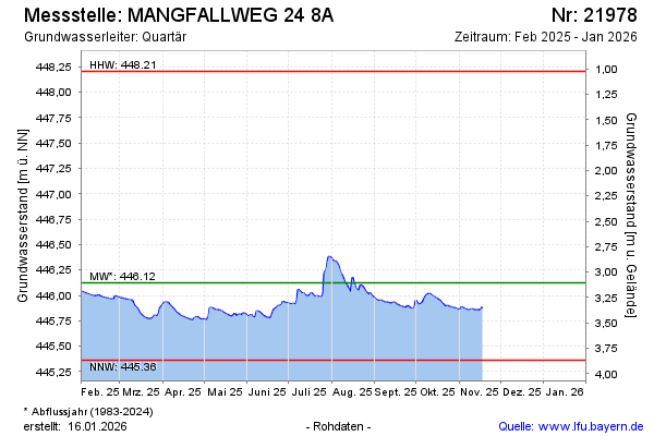
Groundwater level [m above sealevel]: 446.09
Distance to surface [m]: 3.14
Last value from 09.01.2025 13:52
Ground level [m above sealevel]: 449.23
| Date | Groundwater level [m above sealevel] |
|---|---|
| 09.01.2025 | 446.09 |
| 08.01.2025 | 446.09 |
| 07.01.2025 | 446.09 |
| 06.01.2025 | 446.09 |
| 05.01.2025 | 446.07 |
| 04.01.2025 | 446.05 |
| 03.01.2025 | 446.07 |
| 02.01.2025 | 446.06 |
© Bayerisches Landesamt für Umwelt 2025