
- Start >
- Groundwater >
- Waterlevel of upper layer >
- Bayern >
- Mertseebecken 1 >
- Current data

Current data Mertseebecken 1
Groundwater levels of the last 12 months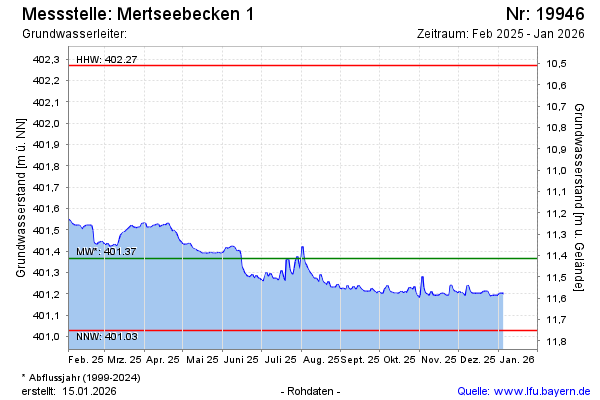
note
GW Messstelle im SN HRB Mertsee EG
Groundwater level [m above sealevel]: 401.60
Distance to surface [m]: 11.18
Last value from 07.02.2025 00:00
Ground level [m above sealevel]: 412.78
| Date | Groundwater level [m above sealevel] |
|---|---|
| 06.02.2025 | 401.52 |
| 05.02.2025 | 401.52 |
| 04.02.2025 | 401.53 |
| 03.02.2025 | 401.54 |
| 02.02.2025 | 401.54 |
| 01.02.2025 | 401.55 |
| 31.01.2025 | 401.55 |
| 30.01.2025 | 401.57 |
© Bayerisches Landesamt für Umwelt 2025