
- Start >
- Groundwater >
- Waterlevel of upper layer >
- Bayern >
- Mertseebecken 4 >
- Current data

Current data Mertseebecken 4
Groundwater levels of the last 12 months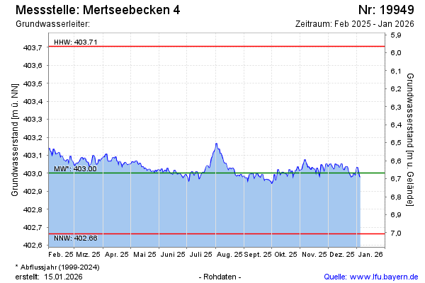
note
GW Messstelle im SN HRB Mertsee EG
Groundwater level [m above sealevel]: 403.33
Distance to surface [m]: 6.33
Last value from 12.11.2024 00:00
Ground level [m above sealevel]: 409.66
| Date | Groundwater level [m above sealevel] |
|---|---|
| 11.11.2024 | 403.09 |
| 10.11.2024 | 403.10 |
| 09.11.2024 | 403.11 |
| 08.11.2024 | 403.11 |
| 07.11.2024 | 403.11 |
| 06.11.2024 | 403.11 |
| 05.11.2024 | 403.12 |
| 04.11.2024 | 403.12 |
© Bayerisches Landesamt für Umwelt 2024