
- Start >
- Groundwater >
- Waterlevel of upper layer >
- Bayern >
- Münchshöf >
- Current data

Current data Münchshöf
Groundwater levels of the last 12 months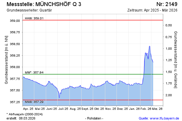
Groundwater level [m above sealevel]: 358.09
Distance to surface [m]: 1.31
Last value from 08.01.2025 13:43
Ground level [m above sealevel]: 359.40
| Date | Groundwater level [m above sealevel] |
|---|---|
| 08.01.2025 | 358.09 |
| 07.01.2025 | 358.04 |
| 06.01.2025 | 357.99 |
| 05.01.2025 | 357.92 |
| 04.01.2025 | 357.90 |
| 03.01.2025 | 357.91 |
| 02.01.2025 | 357.91 |
| 01.01.2025 | 357.90 |
© Bayerisches Landesamt für Umwelt 2025