
- Start >
- Groundwater >
- Waterlevel of upper layer >
- Bayern >
- MUENSTERER - A 16 >
- Chart of total period

Chart of total period MUENSTERER - A 16
Groundwater levels of the total period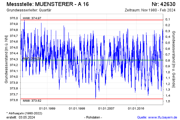
Groundwater level [m above sealevel]: 374.45
Distance to surface [m]: 0.63
Last value from 05.12.2024 12:25
Ground level [m above sealevel]: 375.08
| Date | Groundwater level [m above sealevel] |
|---|---|
| 05.12.2024 | 374.45 |
| 04.12.2024 | 374.46 |
| 03.12.2024 | 374.46 |
| 02.12.2024 | 374.42 |
| 01.12.2024 | 374.43 |
| 30.11.2024 | 374.44 |
| 29.11.2024 | 374.46 |
| 28.11.2024 | 374.45 |
© Bayerisches Landesamt für Umwelt 2024