
- Start >
- Groundwater >
- Waterlevel of upper layer >
- Bayern >
- N1 - HWS Mörnbach >
- Current data

Current data N1 - HWS Mörnbach
Groundwater levels of the last 12 months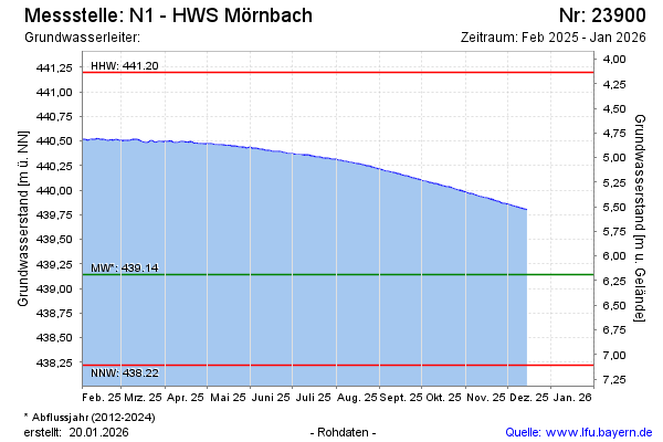
Groundwater level [m above sealevel]: 440.43
Distance to surface [m]: 4.90
Last value from 21.11.2024 08:00
Ground level [m above sealevel]: 445.33
| Date | Groundwater level [m above sealevel] |
|---|---|
| 21.11.2024 | 440.43 |
| 20.11.2024 | 440.43 |
| 19.11.2024 | 440.44 |
| 18.11.2024 | 440.43 |
| 17.11.2024 | 440.43 |
| 16.11.2024 | 440.43 |
| 15.11.2024 | 440.42 |
| 14.11.2024 | 440.42 |
© Bayerisches Landesamt für Umwelt 2025