
- Start >
- Groundwater >
- Waterlevel of upper layer >
- Bayern >
- Oberpöring-Moos-7849 >
- Chart of total period

Chart of total period Oberpöring-Moos-7849
Groundwater levels of the total period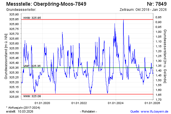
Groundwater level [m above sealevel]: 325.40
Distance to surface [m]: 1.32
Last value from 13.11.2024 13:55
Ground level [m above sealevel]: 326.72
| Date | Groundwater level [m above sealevel] |
|---|---|
| 13.11.2024 | 325.40 |
| 12.11.2024 | 325.40 |
| 11.11.2024 | 325.40 |
| 10.11.2024 | 325.41 |
| 09.11.2024 | 325.41 |
| 08.11.2024 | 325.42 |
| 07.11.2024 | 325.42 |
| 06.11.2024 | 325.42 |
© Bayerisches Landesamt für Umwelt 2024