
- Start >
- Groundwater >
- Waterlevel of upper layer >
- Bayern >
- Obersinn >
- Chart of total period

Chart of total period Obersinn
Groundwater levels of the total period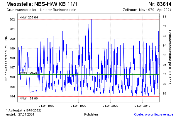
Groundwater level [m above sealevel]: 194.93
Distance to surface [m]: 38.37
Last value from 19.11.2024 09:58
Ground level [m above sealevel]: 233.30
| Date | Groundwater level [m above sealevel] |
|---|---|
| 19.11.2024 | 194.89 |
| 18.11.2024 | 194.81 |
| 17.11.2024 | 194.77 |
| 16.11.2024 | 194.76 |
| 15.11.2024 | 194.77 |
| 14.11.2024 | 194.79 |
| 13.11.2024 | 194.80 |
| 12.11.2024 | 194.83 |
© Bayerisches Landesamt für Umwelt 2024