
- Start >
- Groundwater >
- Waterlevel of upper layer >
- Bayern >
- OBERTHULBA B 212 >
- Current data

Current data OBERTHULBA B 212
Groundwater levels of the last 12 months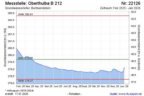
Groundwater level [m above sealevel]: 280.15
Distance to surface [m]: 44.86
Last value from 25.12.2024 10:00
Ground level [m above sealevel]: 325.01
| Date | Groundwater level [m above sealevel] |
|---|---|
| 25.12.2024 | 280.15 |
| 24.12.2024 | 280.13 |
| 23.12.2024 | 280.08 |
| 22.12.2024 | 279.99 |
| 21.12.2024 | 279.90 |
| 20.12.2024 | 279.85 |
| 19.12.2024 | 279.82 |
| 18.12.2024 | 279.81 |
© Bayerisches Landesamt für Umwelt 2024