
- Start >
- Groundwater >
- Waterlevel of upper layer >
- Bayern >
- Perach GWM1-HWS Weitbach >
- Chart of total period

Chart of total period Perach GWM1-HWS Weitbach
Groundwater levels of the total period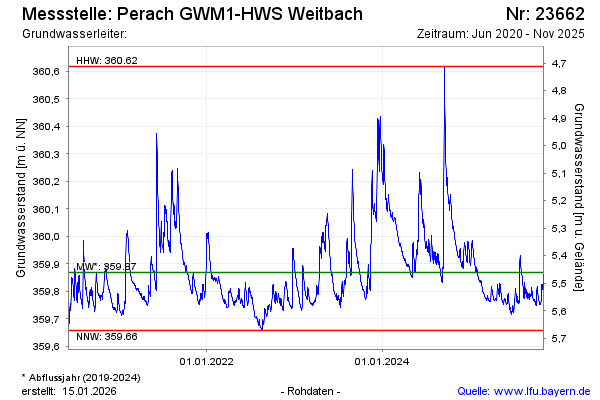
Groundwater level [m above sealevel]: 359.96
Distance to surface [m]: 5.37
Last value from 20.11.2024 13:28
Ground level [m above sealevel]: 365.33
| Date | Groundwater level [m above sealevel] |
|---|---|
| 20.11.2024 | 359.94 |
| 19.11.2024 | 359.93 |
| 18.11.2024 | 359.92 |
| 17.11.2024 | 359.92 |
| 16.11.2024 | 359.93 |
| 15.11.2024 | 359.93 |
| 14.11.2024 | 359.93 |
| 13.11.2024 | 359.93 |
© Bayerisches Landesamt für Umwelt 2025