
- Start >
- Groundwater >
- Waterlevel of upper layer >
- Bayern >
- Pörndorf ost >
- Chart of total period

Chart of total period Pörndorf ost
Groundwater levels of the total period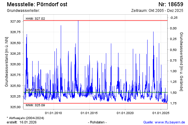
note
GW Messstelle im SN Flussraum Vils
Groundwater level [m above sealevel]: 325.23
Distance to surface [m]: 1.61
Last value from 06.02.2025 11:00
Ground level [m above sealevel]: 326.84
| Date | Groundwater level [m above sealevel] |
|---|---|
| 05.02.2025 | 325.25 |
| 04.02.2025 | 325.27 |
| 03.02.2025 | 325.30 |
| 02.02.2025 | 325.33 |
| 01.02.2025 | 325.36 |
| 31.01.2025 | 325.41 |
| 30.01.2025 | 325.46 |
| 29.01.2025 | 325.36 |
© Bayerisches Landesamt für Umwelt 2025