
- Start >
- Groundwater >
- Waterlevel of upper layer >
- Bayern >
- RAMSENTHAL GWM4 >
- Chart of total period

Chart of total period RAMSENTHAL GWM4
Groundwater levels of the total period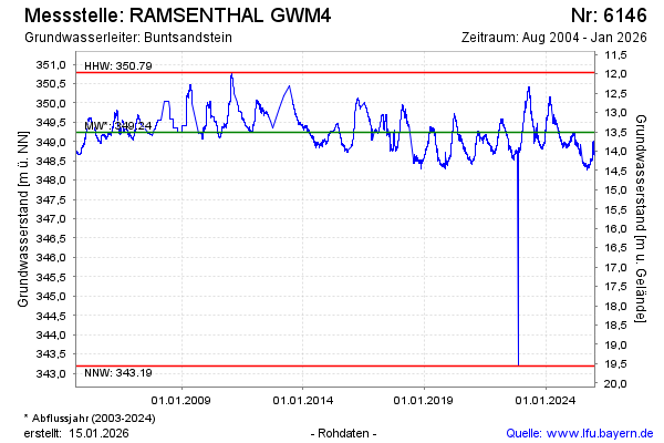
Groundwater level [m above sealevel]: 348.89
Distance to surface [m]: 13.86
Last value from 26.11.2024 09:00
Ground level [m above sealevel]: 362.75
| Date | Groundwater level [m above sealevel] |
|---|---|
| 26.11.2024 | 349.01 |
| 25.11.2024 | 348.89 |
| 24.11.2024 | 348.91 |
| 23.11.2024 | 348.90 |
| 22.11.2024 | 348.89 |
| 21.11.2024 | 348.92 |
| 20.11.2024 | 348.91 |
| 19.11.2024 | 348.91 |
© Bayerisches Landesamt für Umwelt 2024