
- Start >
- Groundwater >
- Waterlevel of upper layer >
- Bayern >
- REGENSBURG 773 >
- Chart of total period

Chart of total period REGENSBURG 773
Groundwater levels of the total period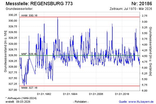
Groundwater level [m above sealevel]: 328.64
Distance to surface [m]: 4.32
Last value from 19.11.2024 09:30
Ground level [m above sealevel]: 332.96
| Date | Groundwater level [m above sealevel] |
|---|---|
| 19.11.2024 | 328.64 |
| 18.11.2024 | 328.65 |
| 17.11.2024 | 328.66 |
| 16.11.2024 | 328.66 |
| 15.11.2024 | 328.67 |
| 14.11.2024 | 328.68 |
| 13.11.2024 | 328.69 |
| 12.11.2024 | 328.70 |
© Bayerisches Landesamt für Umwelt 2024