
- Start >
- Groundwater >
- Waterlevel of upper layer >
- Bayern >
- Reichthalshof MU4 >
- Current data

Current data Reichthalshof MU4
Groundwater levels of the last 12 months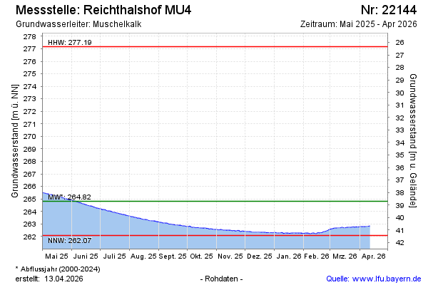
Groundwater level [m above sealevel]: 264.40
Distance to surface [m]: 39.02
Last value from 25.12.2024 10:00
Ground level [m above sealevel]: 303.42
| Date | Groundwater level [m above sealevel] |
|---|---|
| 24.12.2024 | 264.42 |
| 23.12.2024 | 264.45 |
| 22.12.2024 | 264.50 |
| 21.12.2024 | 264.47 |
| 20.12.2024 | 264.45 |
| 19.12.2024 | 264.52 |
| 18.12.2024 | 264.51 |
| 17.12.2024 | 264.50 |
© Bayerisches Landesamt für Umwelt 2024