
- Start >
- Groundwater >
- Waterlevel of upper layer >
- Bayern >
- ROHRBACH HWF P20 >
- Chart of total period

Chart of total period ROHRBACH HWF P20
Groundwater levels of the total period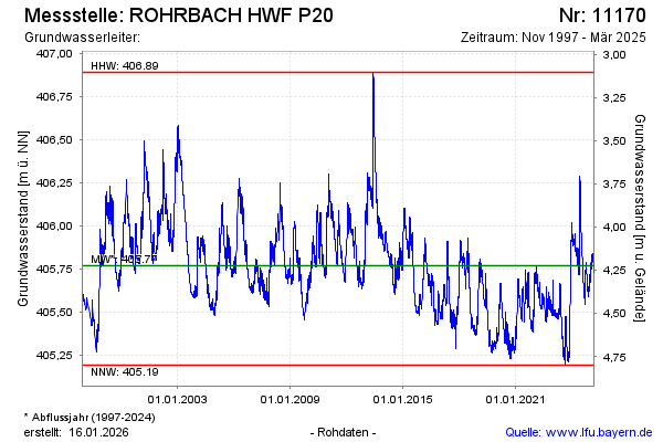
Groundwater level [m above sealevel]: 405.67
Distance to surface [m]: 4.32
Last value from 05.12.2024 11:00
Ground level [m above sealevel]: 409.99
| Date | Groundwater level [m above sealevel] |
|---|---|
| 05.12.2024 | 405.66 |
| 04.12.2024 | 405.67 |
| 03.12.2024 | 405.65 |
| 02.12.2024 | 405.64 |
| 01.12.2024 | 405.64 |
| 30.11.2024 | 405.65 |
| 29.11.2024 | 405.64 |
| 28.11.2024 | 405.63 |
© Bayerisches Landesamt für Umwelt 2025